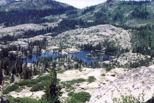
We started at Rucker Lake, on the shores of which is a camp site owned by a group of LDS stakes. From there we hiked up to Blue Lake, along the Blue Lake FLume trail (which is partially built on the remains of an old mining/logging flume). Stopped for lunch on a beautiful outcrop of granite with our feet dangling over the edge. continued the hike to Beyers Lakes, disappointed to find that the streams we had expected to be available for pumping water were bone dry. We found a couple of fetid pools and prayed our filters were as good as advertised. apparently they were, as no one got sick. Beyers Lakes are beautiful. I have no photos, as I took no camera, but I can find some on line and here is Beyers Lake:
camped at BEyers and enjoyed a nice swim the next day. We then hiked over (and sort of around) the Black Buttes and then down to the Five Lakes Basin, staying at Glacier Lake. Very high and cold water, but no snow unlike last year. Next we hiked to and along Send Ridge and past feeley Lake to Carr Lake. THis was my least favorite. We then hiked down to Downey lake, dropped backpacks and day hiked up to Lookout which had a spectacular view. From there we went back to Downey and enjoyed truly spectacular scenery. I slpet that night on the point of a cliff in the lake with the water below me and the moon and sun rising across the lake. I laid on my bag and watched the bats flit around the surface of the lake in the dusk eating insects. It was beautiful. Except near Carr Lake, we saw no one other than our group.
FOllowing DOwney lake we packed up and hiked back down Grouse Ridge to the far end of the flume trial, back along the flume trail past blue lake and back to Rucker. Even though it was straight down hill (literally straight down the ridge fro ~2 miles) it was hard as it really tired out your legs to keep from running.
We also had some day hikes in the mix. Very nice stuff. Once you are more than a few miles from the end of the roads (as almost all of this hike was) you see few if any people. It is amazing how remote you can feel in the middle of California.
If anyone wants more detail or GPS coordinates or USGS map numbers I think I can provide same.